Tuesday March 23, 2004
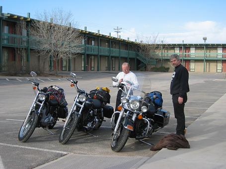
We surprised ourselves by being loaded and ready for departure at 8:00 AM. As the photo suggests, finding a motel with vacancy was not a problem.
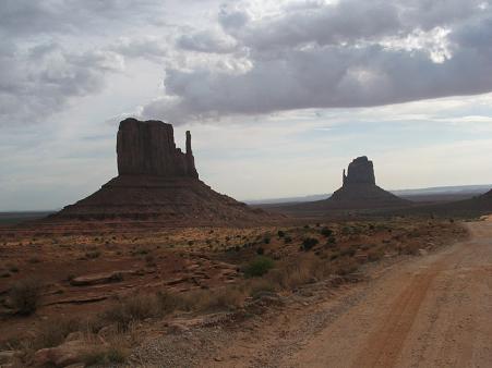
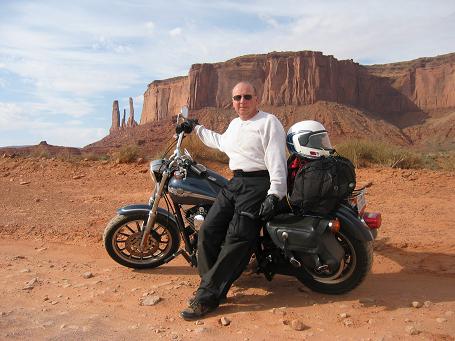
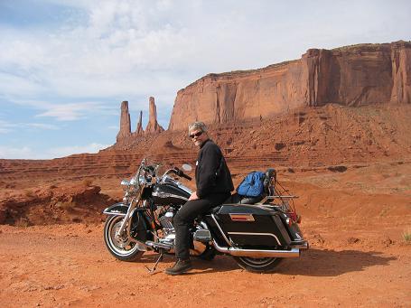
After stopping for fuel, we headed north toward the Utah state line and Monument Valley. The MV visitor area is operated by the Navajo Tribe. For a $5 per person fee, we were able to take the 17 mile self-tour. In planning the day, and considering the distance to be traveled, we had decided in advance that we could have two photo stops in Monument Valley. We must have had around 25. This was the most dramatic scenery of the trip and we were willing to pay the price later for spending more time here. We were in the area for around two hours. One of the first formations we saw is called The Mittens.
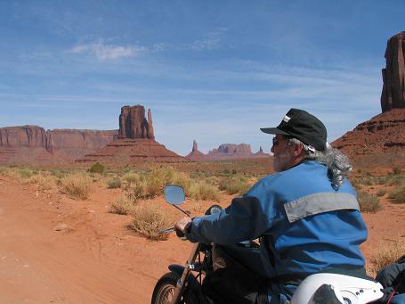
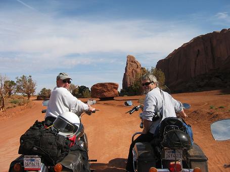
It was soon evident that little of the admission charge was applied to road maintenance. The road was a combination of stone, rock, and sand. Much of our attention was directed toward keeping the wheels going the right place. The sand bits were particularly challenging, but we all managed to keep our machines upright.
Considering that we were going under 10 MPH, we soon exchanged our helmets for more appropriate head gear. Thanks, Mike Molter!
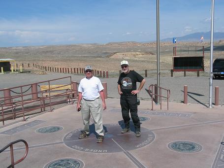
The next destination was Four Corners, but on the way we saw more beautiful country. We rode past the rock formation for which the town of Mexican Hat, Utah is named. The Four Corners monument is also operated by the Navajo Nation. It is the only place in the US where four states come together. Ed is in UT and AZ; Barry in CO and NM.
Surrounding the monument were small stands where the local Navajo artists sold their pottery, jewelry, painting, etc. Some of the artists were working in the stands.

We had Frito Pies for lunch and then moved on. Our final destination for the day was Taos, many miles to the east. US160 took us to US64 for the rest of the way to Taos.
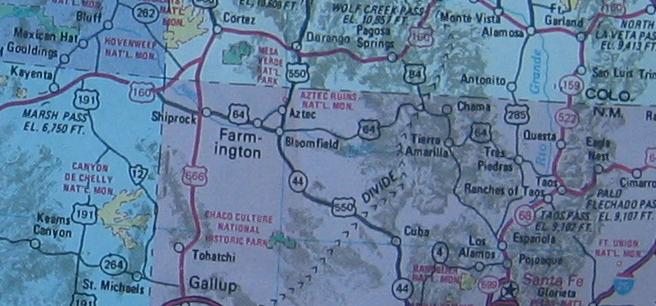
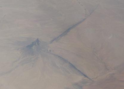
The formation namesake for Shiprock, NM was visible for a long time, jutting up out of miles of surrounding desert. On the flight west, Barry took a photo of Shiprock from several miles up. It shows the trailing ridges that resemble the wake of a ship.
We stopped for fuel in Farmington, home of the Farmington High School Scorpions. To the south we could see storm clouds with occasional lightning. We were starting to realize that it could be a late arrival in Taos. At the fuel stop in Chama, 6:00 PM, we learned that we had another two hours and daylight was disappearing. We knew that we had mountains to cross, so we put on all that we had for keeping warm. It was a good thing. About an hour later we had climbed to the Continental Divide and the temperature was definitely lower. The road was in good condition, but we were in full darkness by then and found the Elk Crossing and similar signs slightly disconcerting. The upper elevations had lots of snow, but we learned later that the pass had been kept open all winter. For a good part of the crossing we followed a car, but encountered almost no oncoming traffic.
The lower elevations on the east side of the mountains were most welcome. When we could see the lights of Taos a good 25 miles away, we knew we were going to make it. Most of the landmarks were hidden by the darkness, so when we stopped to get directions, there was much stretching. We used that opportunity to call Mary Hobratschk to request that the coffee and water for hot chocolate be ready for our arrival. At Mary's place we decided that a pizza delivery beat the prospect of more road travel.
393 Miles for the day.